Three historic villages along the route of the Via Francigena in the upper Gran San Bernardo Valley, between 1,200 and 1,600 metres, with stone and lose architecture and landscapes of high mountain pasture.
The Gran San Bernardo Valley narrows as it climbs toward the Swiss border, and with it narrow the stories of the three villages that mark its floor: Étroubles, at roughly 1,280 metres, Saint-Oyen a little higher still, and Saint-Rhémy-en-Bosses, which rises past 1,600 metres before the road begins its climb toward the Colle. This alpine corridor was already in use in Roman times as a stretch of the Via delle Gallie, the artery linking the Italian peninsula with the territories beyond the Alps. In the Middle Ages the same route became part of the Via Francigena, the itinerary that led from the archdiocese of Canterbury to Rome, documented in 990 AD by Archbishop Sigeric of Canterbury on his return from the papal seat.
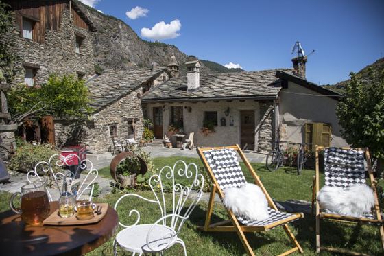
Étroubles carries in its built fabric the layered memory of this centuries-long passage. The houses of local stone, roofed with lose — the grey stone slabs typical of alpine building in Valle d'Aosta — line cobbled lanes whose irregular geometry still follows the logic of a village made for passing through, not for stopping: built to receive travellers rather than hold them. Along these same paths the municipality, working with the Fondation Gianadda of Martigny, has installed sculptures and paintings by Italian, French and Valdostan artists — among them Albert Féraud, Giulio Schiavon and Siro Viérin — turning the public spaces into a permanent open-air exhibition. The sculptures depict wayfarers, the postilion, the traditional Landzette figures: presences that speak to the place's history without overwriting it.
Saint-Oyen and Saint-Rhémy-en-Bosses share the same architectural grammar, though rising altitude lends each village its own measure of austerity. At Saint-Rhémy, the last settlement before the pass, high mountain pastures press close around the houses — a presence that in summer is green and dense, and in winter shrinks to a silence of stone and snow. Here the Via Francigena, before its final climb toward the 2,473 metres of the Colle del Gran San Bernardo, turns from road into path. Those who travelled this stretch in the Middle Ages knew the pass could remain closed for months: the villages were also this, a threshold beyond which crossing became uncertain.
What the three settlements share is not only their position along a historic route, but the continuity with which they have kept their function as inhabited places at altitude, without ever becoming mere sites of memory. Their architecture is not preserved like an artefact: it is still lived in, still subject to time and use. The Via Francigena that runs through them is now recognised by the Council of Europe as a European Cultural Route, but the villages that mark its course through this valley existed before that designation and continue, in their quiet way, to exist independently of it.
Hagai Agmon-Snir حچاي اچمون-سنير חגי אגמון-שניר · CC BY-SA 4.0 — Wikimedia Commons
Certified Made in Italy businesses close to this place.