Four villages in the Grand-Saint-Bernard valley that keep intact the memory of the Aosta Valley's agricultural and pastoral world, far from the more well-trodden tourist routes. The landscape and rural architecture tell of centuries of alpine life bound up with livestock farming and the cultivation of the land.
The Coumba Freida — the "cold valley" in Franco-Provençal patois — is the name given to the system of valleys that opens up southwest of Aosta, along the course of the Buthier stream, in the direction of the Grand-Saint-Bernard. Four minor municipalities are distributed across this territory: Ollomont, Bionaz, Valpelline and Doues. Valpelline is recognised as the longest side valley in the entire region, climbing up to the Swiss border, where it is closed off by glaciers and by the Dent d'Hérens, at 4,171 metres. To the east, the ridges of the Grandes Murailles separate it from Valtournenche; to the west, Mont Vélan, at 3,727 metres, marks the border with the Grand-Saint-Bernard valley. This is a geography that has kept organised tourism at bay, and has for that reason preserved a working mountain landscape in which nature has never been reshaped by heavy infrastructure.
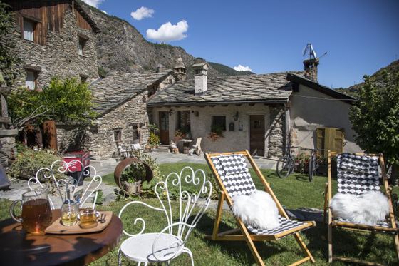
The architecture of the villages speaks directly to this history. The stone-and-timber buildings that dot the slopes follow a logic of necessity: stables on the ground floor for the warmth of the animals, living quarters above, hay barns set against the hillsides to reduce the work of transport. The economy that shaped these settlements was built on livestock farming and seasonal transhumance to the high pastures, with a collective management of resources whose traces can still be read in the organisation of the land. The Buthier stream, which runs through the valley gathering numerous side gullies left without even unpaved roads, is the thread that holds these scattered fragments of settlement together.
Among the side valleys, the Combe de Montagnayes is home to the Montagnayes Nature Reserve, a protected area that safeguards a range of habitats — from woodland to alpine grassland — along with the plant and animal species that live there. It is one of the few cases in which formal protection has been layered over a territory that human pressure had already spared, quite naturally, on its own.
The collective memory of these villages also shows itself in the ritual calendar. The Carnival of the Coumba Freida is documented, according to local tradition, from at least 1467, and is distinguished by masks and characters of its own, tied to the valley's specific culture. The occasion celebrates the end of winter with a liveliness that contrasts with the territory's otherwise secluded character for the rest of the year, and represents one of the moments in which the communal identity of these settlements becomes visible to the outside world.
What unites Ollomont, Bionaz, Valpelline and Doues is not simply geographical proximity, but a cultural continuity rooted in the shared management of the high pastures and in the language — the Franco-Provençal patois — that gave the valley its very name. In a region where tourism has often singled out places for their large ski areas or medieval monuments, the Coumba Freida has remained outside that selection, and still bears the marks of an alpine economy and sociability that elsewhere have been transformed or have faded away.
Patafisik · CC BY-SA 3.0 — Wikimedia Commons
Certified Made in Italy businesses close to this place.